Loch Awe crannogs 1972 – analysis of results
Measurements in chart form
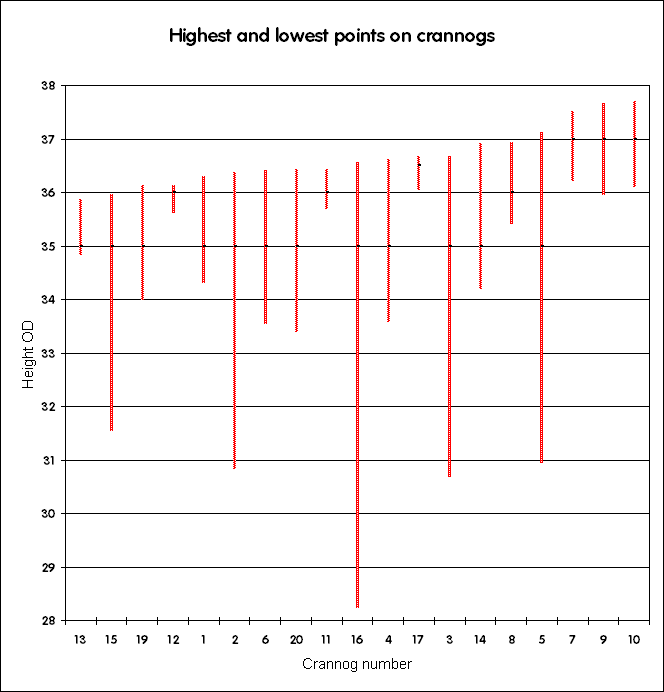
From the top of the crannog to the deepest of the building stones
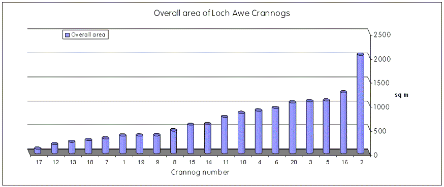
Overall area of crannog spread
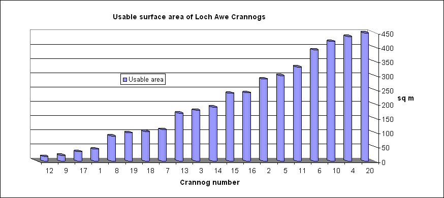
Our estimate of the usable area of the crannog, based on the top surfaces we saw in 1972.
Crannog plans and profiles
These plans were drawn up after we returned to Edinburgh after the exped, in October 1972. We used our original survey figures, and had the larger (1:100 scale) plans to consult. They were done in pencil, later traced off in ink for other illustrations, such as the article in The Kist. They are now very grubby, sorry, and won't process much without losing detail. Still readable, if you're interested – in pdf format at 100% – main interest is the profiles. Consult the main crannog plans for any surface features that are not explained – they are just traced off these
Crannog plans: click on number to open pdf files1 | 2 | 3 | 4 | 5 | 6 | 7 | 8 | 9 | 10 | 11 | 12 | 13 | 14 | 15 | 16 | 17 | 18 | 19 | 20 |
Back to front page